SOLITAIRE
Llangattock Escarpement & Abergavenny Loop
The weather wasn't spectacular, but I simply did not care. Getting out on my bike and just riding was my utmost desire. And it felt wonderful to be on the road again, wandering wherever I chose.
My cycling has really suffered from the Covid-19 restrictions this year. Going out for all-day rides and covering long distances has been nearly impossible. Then we've had days on end with heavy rain and wind... it's been just a miserable Autumn.
So the first question I asked myself on this dark and dreary morning was; "where to go?" Not quite sure, I simply got on my bike and headed north.
Overview - Llangattock Escarpement & Abergavenny Loop
Distance: 67.8 miles
Elevation: + 4397 / - 4432 ft
Duration: 06:31:01
I've not divided the report into stages beause it was pretty straight-forward; I simply rode to Abergavenny and came home.
[ The map above is interactive! You may select a particular section to view the details. ]
The majority of my ride was along well-known cycle routes of the National Cycle Network which I've highlighted throughout the narrative. (I've also included Relative Links in the Summary at the end of this report.) For closer inspection, I suggest enlarging the embedded map via the link provided above. Thanks again to Ride with GPS for their excellent website. ▼ Jump to Summary
I started just outside Blackwood on NCN Route 467 and continued up through Georgetown to Tredegar. From there, I joined NCN Route 46 and I cycled east across the Heads of the Valley to Brynmawr.
I left the cycle route outside Brynmawr and headed north along Hafod Farm Road. This desolate road sits high across the valley from Clydach Gorge and runs around the mountain to Llangattock Escarpement.
Surprisingly, patches of blue sky began to appear, but the temperature was still quite chilly at just over 10°c. And too, it was very windy.
I've shot better photographs from along here (See my report from 2018; "Llangattock & Abergavenny".), but it is so damn dramatic, I couldn't resist. Plus, it was good to play with my new camera.
If you look closely, you can just barely make out the Lonely Shepherd along the ridge in the photo above. (See my report from 2017; "The Lonely Shepherd".)
I cycled into a heavy mist as I neared the end of Hafod Farm Road. The escarpment is barely visable high on my left.
At the end of this section there are two options; turn around and head back to Brynmawr or cycle down an extremely steep and winding lane to the village of Llangattock. (The elevation drops 625 feet in .75 of a mile... roughly a 15% decline!) You know what I chose.
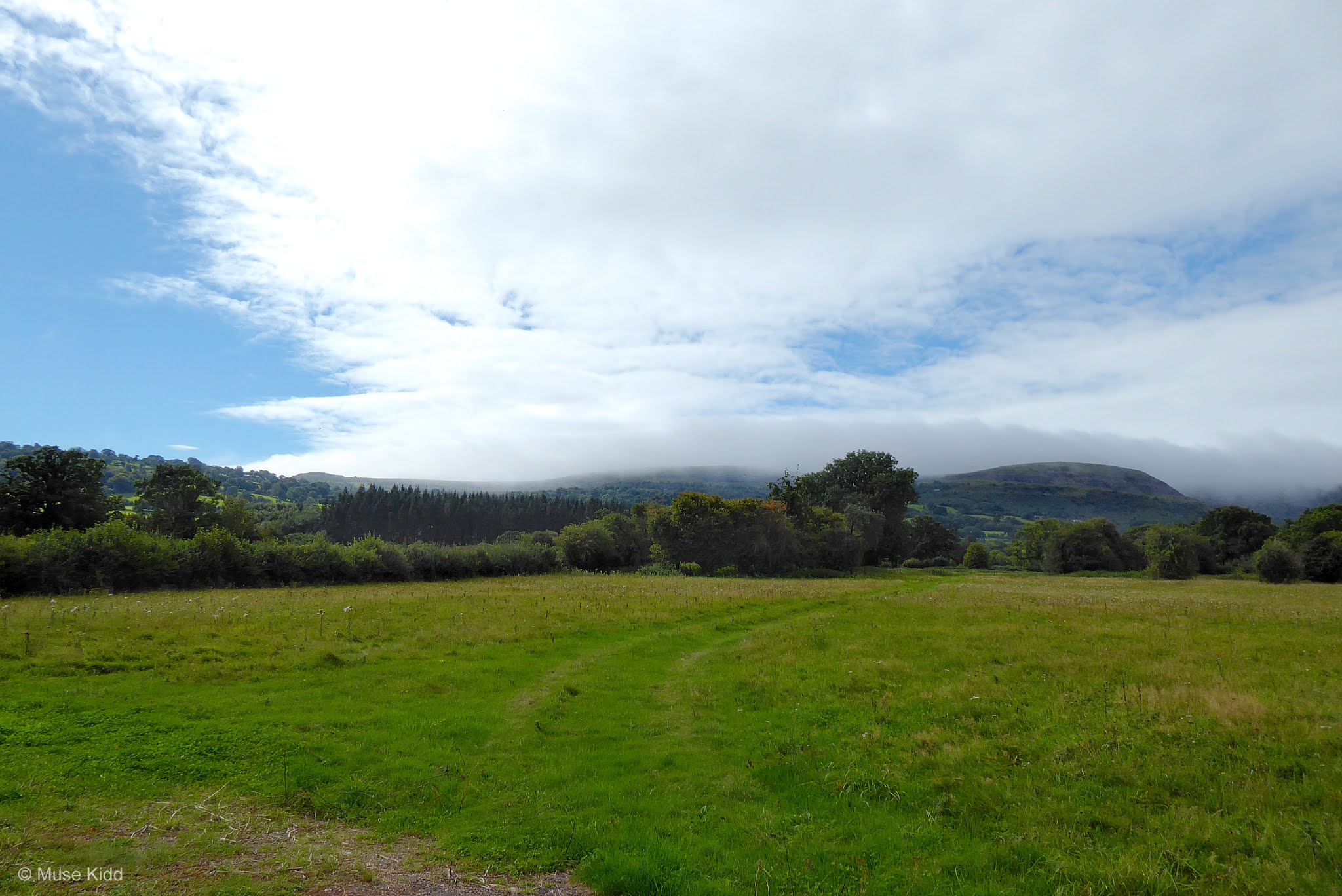
Once at the bottom, the road flattens out. I turned south and started for Abergavenny. A mile or so down the road I could look back and see where I had been, but the escarpment itself was mostly obscured by heavy clouds and mist.
Public Toilets
No, it's not a terribly interesting bike shot... I'm sure I will question my choice with including it here. But, I am so impressed with the fact that public toilets actually exist in the UK. They are wonderful and show such a degree of class and sophistication.
You won't find public toilets in the United States. That is specifically, stand-alone buildings with public facilities. Why is that you may ask? You cannot have public toilets such as this in the US because the homeless would move into them. It's sad, but true. But speaking of which... let us move on.
The sun came out as I entered Castle Fields in Abergavenny and it made for a perfect location to stop for lunch. The temperature warmed up nicely and as you can see... it was lovely.
Leaving out of Abergavenny, I climbed onto the Monmouth & Brecon Canal (NCN Route 49). Looking over the hedges across the Usk Valley, the Skirrid looms broken against the skyline and late summer corn stands patiently for the scythe.
It's easy to get lost in your thoughts along the canal path. Ringing my bell, I often hear the passing comment; "I was was miles away just then!" And I guess that's part of the beauty... it is absolutley serene.
Forgive my ignorance, but I cannot fathom having such a fabulous boat house along the canal and not making use of it? What a cool architectural element, eh?
I appreciate the practical application of wrapping hay bales in plastic, but what I don't understand, is why some use black. The dark colour increases the growth of bacteria in the silage which decreases the protein value. And it just doesn't look nice, in my humble opinion.
There has been a noticable surge in landscaping along the canal over the past few years. This home seems to have been motivated by the Swiss Family Robinson. That bridge looks great from down here. I wonder what the view is like up there AND what else lurks in the trees that we cannot see? So cool!
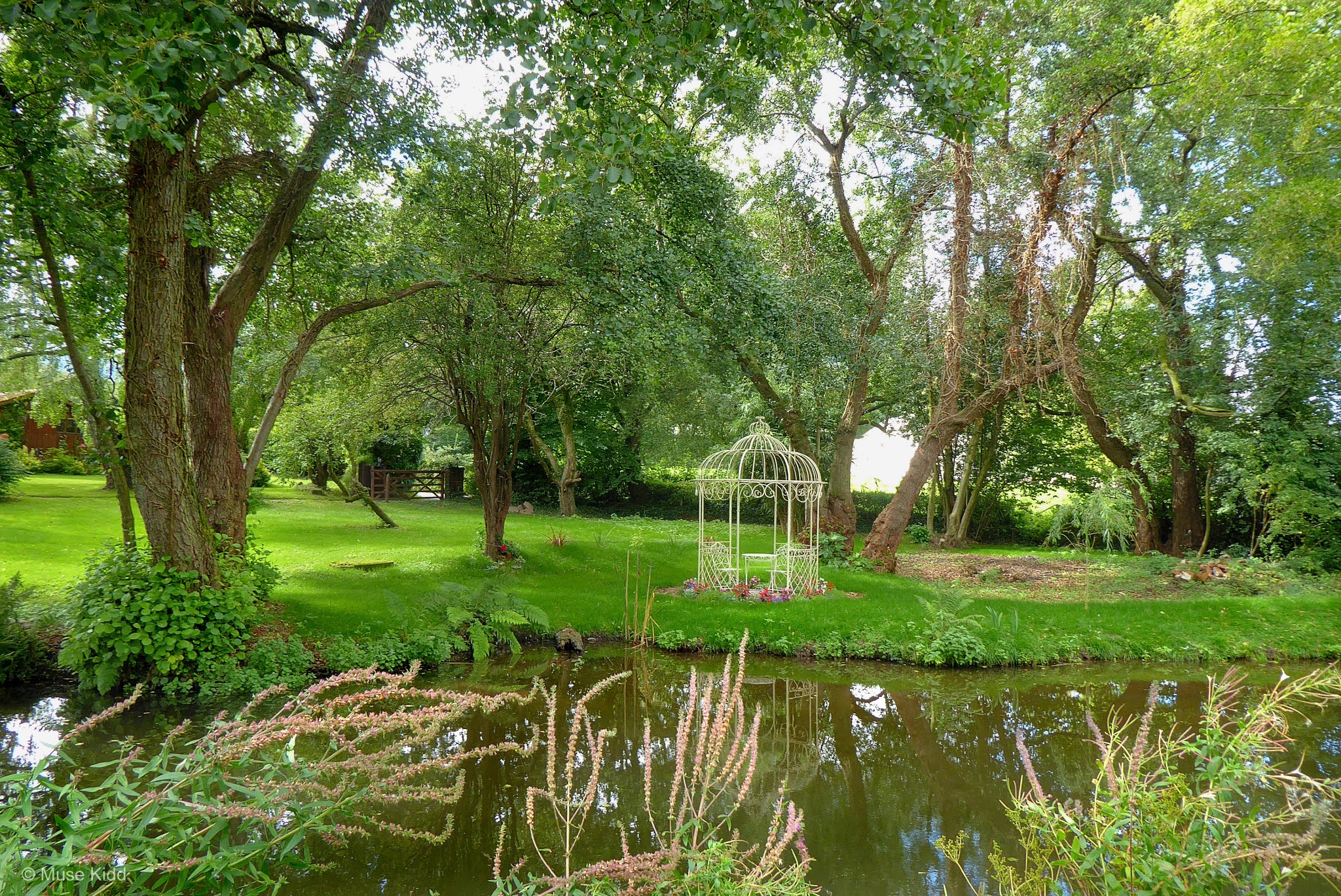
Though it's not my particular taste in landscape design, this does look nice despite it's bird cage or "pastry" connotations.
But time and time again, I stopped to take a photo. There's nothing more to be said... it was simply a stunning afternoon.
One last parting shot and I called it quits. I could have stayed out longer and taken loads more photos, but it was time to focus on getting home. I'll be back soon again.
Summary - Llangattock Escarpment & Abergavenny Loop
This route has become rather common-place for me now, but it was great to be out for a longer ride. I was relaxed and just took my time. A lazy day ride.
The sun was in & out all day and the temperature held around 19°c.
The Abergavenny high street was mobbed with people, so I just passed through as quickly as possible. I'm not comfortable around large crowds with this pandemic still floating about. The canal path was desolate coming home.
Thanks as always for stopping by.
Cheers! - cm
 |
Report Card |
|
| Ride Name: |
Llang & Abergavenny |
| Start Date: |
Tue. Sep. 08, 2020 |
| Starts in: |
Oakdale, Wales, GB |
| Departed: |
8:12 am |
| Distance: |
67.8 mi / 109.11 km |
| Elevation: |
+ 4397 / - 4432 ft |
| Max Grade: |
12.8% |
| Duration: |
09:14:24 |
| Move Time: |
06:31:01 |
| Stop Time: |
02:43:23 |
| Max. Speed: |
28.9 mph |
| Avg. Speed: |
10.4 mph |
| Weather: |
part cloudy, sun |
| Temp: |
19°c / 66°f |
The following NCN routes were used either in part or in whole.
|
 |
Route 467
Blackwood to Tredegar |
 |
Route 46
Tredegar to Brynmawr |
 |
Route 49
Llanfoist - Pontypool |
 |
Route 466
Pontypool - Llanhilleth |
|


 You won't find public toilets in the United States. That is specifically, stand-alone buildings with public facilities. Why is that you may ask? You cannot have public toilets such as this in the US because the homeless would move into them. It's sad, but true. But speaking of which... let us move on.