This isn't a new route for me, but I generally cycle it in the opposite direction. This turn-around yielded some surprising discoveries.

Overview - BIG! Caerphilly Ramble
Distance: 82.2 miles
Elevation: + 4985 / - 4985
Duration: 10:25:28
For the majority of this ride I stayed in Caerphilly county. However; I did slip out for a few miles whilst on the Taff Trail from Nantgarw to Quakers Yard. As you can see from the map below, the route is essentially a big figure-eight with another loop added to the side. The route was a pretty easy and great fun to ride. ▼ Jump to Summary
I first made my way up to Pen-y-Fan Pond above our house as a warm up. I then zig-zagged my way to Newbridge attempting to pile on as many easy downhill miles as possible. From there I shot along the Crumlin Arm of the M&B Canal to 14 Locks where I turned around and came back up through Waunfawr ParK to Sirhowy Valley Country Park.
Elevation: + 4985 / - 4985
Duration: 10:25:28
This next part of the ride is better known as the Three Parks Trail which follows NCN Route 47 & NCN Route 476 connecting Sirhowy Valley Country Park, Parc Penalta, and Parc Taf Bargoed. That completes the first 32 miles or the outer loop shown on the right in the map above, a decent ride on it's own, but we've got more!

Gelligaer Common
Before I begin with the photos, I should clarify that I only photographed one section of about eight miles (shown above). This part of my route passes along the high ridge of Gelligaer Common and a vast open space above Fochriw I call the Fochriw Highlands.


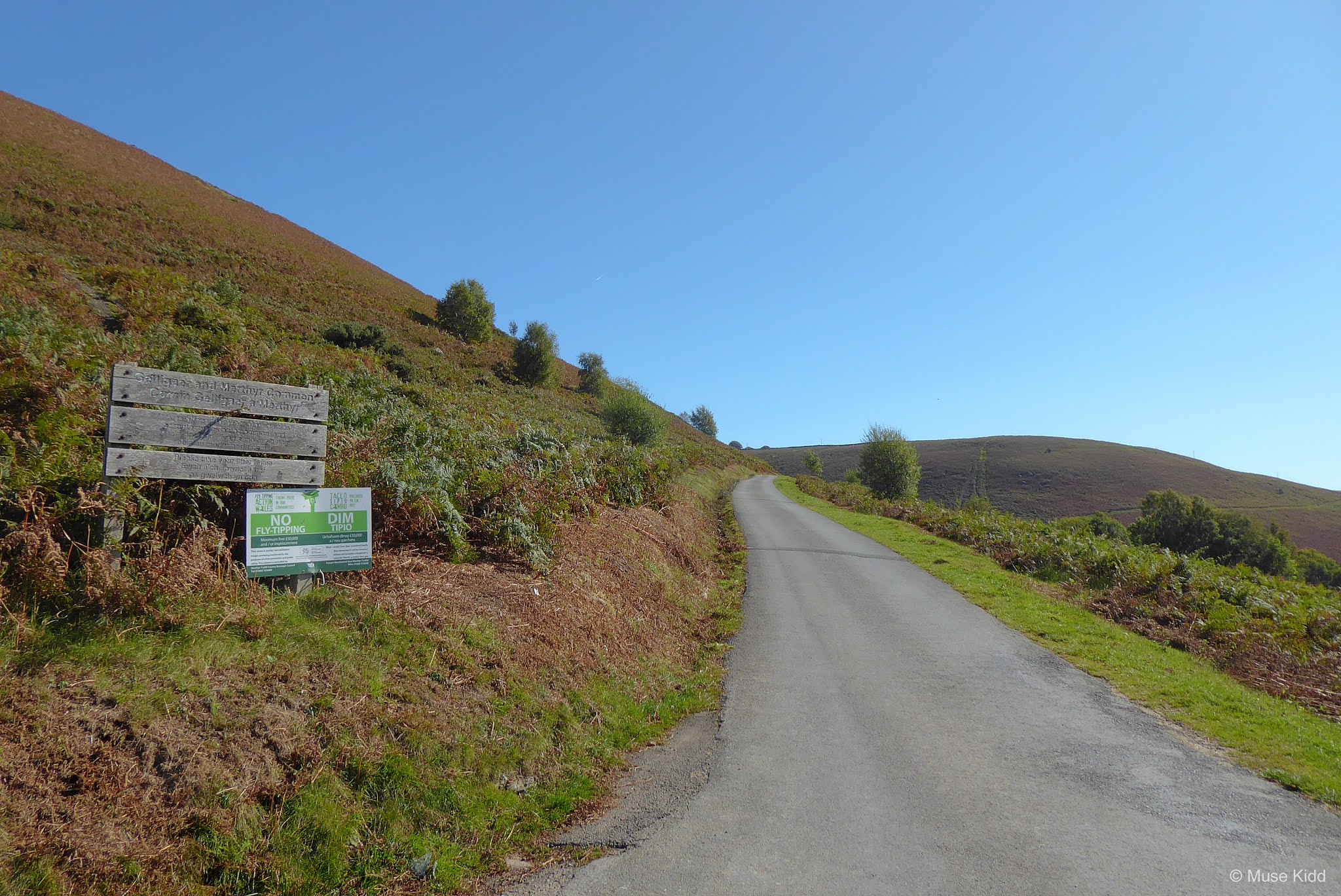


I've been down this road many times, but mostly from the opposite direction, so I had not seen this marker before. Later, when I returned home I did a bit of research (as ya do...) which lead me to discover even more intriguing surprises...

Cairn y Bugail
There is a ring-cairn dating back to the Early Bronze Age (2000–1450 BC). The site comprises a turfed-over bank of about 45 feet (15m) in circumference.

Ring-cairns had religious purposes and are a variant of the stone circles and were often used as burial grounds for Bronze Age farmers and shepherds.

As you can see from the Ordnance Survey map above, there are many cairns in the area. It will be well worth going back with proper shoes and a lunch for an afternoon of exploring!
Read more at CADW; Gelligaer Common — An Archaeological Surprise and Gelligaer Historic Landscape
I couldn't spot the standing stone with my naked eye, so I used the zoom feature on my camera and voila! Now that I know a bit more about this area, I'll be returning with a plan. I just love Wales!


Moving on the road widens as it joins the main road up from Bedlinog. That road, by the way, is supposed to be one of the steepest in Wales... so yeah, I don't generally go that way.


Off to my right and far below me is the sleepy little village of Fochriw. The locals here refer to it as "the end of the world".


Then I notice this road off to my left. I've seen it before, but today it perks my interest. It's blocked off with a gate by the main road, but there's a gap at the side. Nothing says it's private or to keep out, so I'm giving it a go.

The old vs. the new. I wonder what was that stone structure?

I love a road to nowhere; however, I can see that it turns back toward Bedlinog. I'm unsure how far it goes.


Nothing but the sound of the wind.


I stopped again because I could see the track was heading off down the hill. I'm pretty sure there's a rail line down there and a farm, but I don't know if there is any public right of way. It's a perfect place to pop open my flask, have a cup of coffee and a sandwich before heading back.


Fochriw Highlands
Back at the main road after my little explore, but before I can turn left, a couple in a SUV pull up and ask what's down the road. I chuckle and reply; "nuthin'". The look on their faces was priceless!

The pond off to my right hasn't any proper name that I can find. It looks man-made, but I have no idea for what it was used?
Ahead, fenced off on my left is some sort of electrical equipment. Behind that is the entrance to the Merthyr (South Wales) Ltd., a massive surface mining quarry. (Check out the map below for more details.)
Ahead, fenced off on my left is some sort of electrical equipment. Behind that is the entrance to the Merthyr (South Wales) Ltd., a massive surface mining quarry. (Check out the map below for more details.)


Now I've traveled down the road and turned left heading toward Fochriw. You can see the road I've come down in the far distance as it swings around the hill and the pond looks rather inviting.


I love this.


I just cannot believe that I'm only 15 miles from home.


I ran into a gang of young boys on their moutain bikes as I came through Fochriw. They were like a pack of wild dogs chasing after me, hootin' an' hollerin', asking; "where ya from?" and "where ya going?" and of course; "pop a wheelie!" I just laugh, shake my head and tell 'em I'm too old. Good guys they are too, they laugh and call me "old bicycle-man", but cheer me on too.

Just outside of town now, heading south toward Deri, I pick up the traffic-free cycle path; NCN Route 469. The loggers gave that hill a rather odd haircut, I'd say?


I'm down between the ridges now. There's no wind and the only thing I can hear is the water trickling over the rocks in the stream and an occasional sheep somewhere on the hills above me. The shadows are getting long and I'm sarting to feel a bit tired.

I stop for one last photo overlooking Parc Cwm Darran from the cycle path. It's a lovely park, but it's pretty crowded today, so I just keep on going.
Summary - BIG! Caerphilly Ramble
When I got back down to Hengoed/Maesycwmmer I could have turned right and headed home. I had cycled just over 50 miles. It had been a good ride, but something said to me to keep going. So I did.
I cycled the lower loop down to Caerphilly aross to Pontypridd and back up the Taff Trail to Quakers Yard. Then I came home through Parc Penalta (again!). Easy Peazy.
The weather was spectacular. The temperature stayed around 16°c. for the entire long-late-summer day. Traffic was of little concern because for most of the ride was either way up on the mountains or cycling along traffic-free cycle paths.
It was a fabulous day and my second longest ride of the year. I'm a lucky boy.
Thanks as always for stopping by.
Cheers! - cm
It was a fabulous day and my second longest ride of the year. I'm a lucky boy.
Thanks as always for stopping by.
Cheers! - cm
|
|
|||
| Ride Name: | BIG! Caerphilly Ramble | ||
| Start Date: | Sun. Sep. 27, 2020 | ||
| Starts in: | Oakdale, Wales, GB | ||
| Departed: | 08:29 am | ||
| Distance: | 82.2 mi / 132.29 km | ||
| Elevation: | + 4985 / - 4985 ft | ||
| Max Grade: | 12.4% | ||
| Duration: | 10:25:28 | ||
| Move Time: | 07:52:08 | ||
| Stop Time: | 02:33:20 | ||
| Max. Speed: | 34.3 mph | ||
| Avg. Speed: | 10.4 mph | ||
| Weather: | sun, sun, sun! | ||
| Temp: | 16°c / 60°f | ||