Introduction

Welcome to the Archive. Here you'll find all of my ride reports from the first eight years of cycling in Wales. The layouts used here are in the previous design which I'm currently updating, so be sure check back!

Thursday, August 25, 2016

SOLITAIRE 
Blaengarw &
Nant-y-moel Tour

This report is part two of my weekend exploring the Rhondda Valleys. Today's ride covers the lovely Rhondda Fawr Valley.
Innocent looking lane heading out of town...
Along with the two valleys I've explored, each ride also contains a significant mountain climb. The following report covers the second of these big climbs; the Bwlch. (My previous report covered The Rhigos.) Both mountian climbs are popular with cyclists and have been a featured part of the Tour of Britain in Wales numerous times.

Overview - Blaengarw & Nant-y-moel Tour
Distance: Distance: 84.7 miles
Elevation:+ 6314 / - 6313 ft
Duration: 13:06:03
The ride down to Pontypridd was just as I had made the day before... easy-peazy across NCN Route 47 to Quakers Yard and then down the Taff Trail (NCN Route 8). Both routes are well-marked and well-paved. ▼ Jump to Summary
Oakdale to Tonyrefail
At Pontypridd this time I got onto NCN Route 4 heading west. Now I've been on this route a few times and its lovely, BUT... I have to add that this section is one of the hardest I've ridden on the National Cycle Network. The climb out of Pontypridd is brutal to say the least. It is long and steep and seems to go on forever. (NOTE: You can see an annotation of this section on the map if you view the larger version... )

Note: I didn't take any photos of the climb. But once at the top, the ride is really lovely and rolls along through some seemingly isolated valleys thick with trees and lush overgrowth.
Looking over yonder valley...
Time to ride back down...
Surprisingly too, the paved road sort of fades out to a very rough bridleway. It's slow going in places and it's pretty rutted out from the rain. But despite the change, it is short-lived and you'll find yourself back on smooth tarmac before dropping into Tonyrefail.
A sudden change in road surface...
Looks like an adventure to me...
Looking back over my shoulder...
I have to be honest too... I kinda dig this sort of bridleway. It's not too difficult to manage. Sure I had to get off a couple of times because the gravel was too large or there was an unusually large gully across the path, but it totally adds to the "adventure feel". And then before I knew it... I was back on a paved roadway.
Nothing but the sound of wind...
and bird calls...
and in the distance a dog is barking...
and the sheep hear it all.
Coming out of the wild country I headed into Tonrevail and entered what I guess to be the city park? And then I promptly got lost. I don't know if I missed a sign or what?... but, I had no idea where to go.

Thank goodness I had brought along my Ordinance Survey maps. Plus, I had my Garmin Tour... so between the two I successfully navigated my way out of there! What this means to you dear reader... is that I didn't document my confusion. (You can see it on the map though...HA!)
Crossing paths...
Ogmore Junction to Blaengarw
Once back on course, the route was fabulous... yet again. In fact, looking back I can't believe I didn't take more photographs? It's a testament to how pretty this little country is. I was completely in the zone of "gazing at the beauty of Wales".
Down along the Ogmore River, the scenery changes completely...
Yup, those are real flowers...
From high mountain passes to thick wooded jungle...
I got a bit turned around looking for Bryngawr Country Parc and found myself riding up the A4064 from Brenminyn to Llangeinor. And for an "A" road it's actually not bad to cycle. It has a gentle slope, but the traffic is mild and the cars gave me plenty of room.

I found the path at Llangeinor by the old train station where it comes out of the woods and settles up along the old Gawr Valley rail line. I have to say, from here on up to the top of the valley was like stepping back in time. The entire area just felt as if it was cut off from the rest of the world.
Once a bustling and lively train station is now a lovely and quiet home...
nuthin' but the sounds of chickens and my tyres rolling along...
It's lovely... and quiet... and incredibly scenic... in a very low-key, understated way. I could clearly hear children joking and playing across a small pond as I passed. I could make out every word from women chatting somewhere in the near distance, but couldn't see them.
With no idea of what lies ahead...
Little gems appear...
with the whisper of a secret valley discovered...
And so with little fanfare I reached the top of the valley. I had thought I might try to follow a logging road that climbs up behind the houses and through the woods to the other side, but following a brief conversation with a local fella, I decided that it might be too much. Now home and looking at the area in Google Earth... it was good advice.
At the end of the road...
I had my lunch sitting on bench looking at this little valley trying to soak it all in. I'm always stunned at how much you can see in such a short space... in such a small country. It's a treasure chest packed with fascinating history and amazing scenery and lovely, wonderful people.
Another look around...
before heading back down the path as I had arrived...
Coasting back down the path I stopped along an old rail siding to snap a few quick photos when I was approached by a young man asking if I'd like to see inside the train shed. HELLO?!?! Would I ever... yes, please.
Abandoned?... Disused?...
Forgotten?... Unappreciated?...
No!
Sleeping perhaps...
Awaiting a second life...
And then I was off again! Shaking my head... the hits keep on coming! Heading up to Nant-y-moel next... What more can I see today?
I'm just loving these old rail lines...
How perfect to convert them to walking and cycle paths?
And how best to see the valleys?
Hello pony!
Looking back down the valley.
Looking up and out of town...
NOTEWORTHY
The Bwlch
It's that time again to kick you over to the Gallery section of my blog. Leaving Nant-y-moel was somewhat auspicious. Not only have I loaded this post with perhaps too many photos, but the climb up and over to Ton Pentre deserves it's own space. Take a moment to review the map... noting the climb and descent. There are three routes to the top of this mountain. The one I've taken is the shortest and easiest!

Summary - Blaengarw & Nant-y-moel Tour
This was the second day of my tour where I set out to explore the Rhondda Valleys. These valleys; the Rhondda Fach and Rhondda Fawr, are west of where I live and normally ride. They are of equal notoriety for their role in the coal mining industry during the heydays of the Industrial Revolution, yet they are now somewhat removed from common routes.

Thanks as always for stopping by.

Cheers! - cm
Report Card
Ride Name: Blaen & Nant
Start Date: Sun. Aug. 14, 2016
Starts in: Oakdale, Wales, GB
Departed: 7:17 AM
Distance: 84.7 mi / 136.31 km
Elevation: + 6314 / - 6313 ft
Max Grade: 13.2%
Duration: 13:06:03
Move Time: 08:28:49
Stop Time: 04:37:14
Max. Speed: 33.5 mph
Avg. Speed: 10.0 mph
Weather: clouds, sun
Temp: 19°c / 66°f

Saturday, August 20, 2016

SOLITAIRE 
Maerdy & Treherbert Tour

This ride is part one of my weekend exploring the two valleys of the Rhondda; the Rhondda Fach & the Rhondda Fawr. Today's report covers the smaller of the two: the lovely little Rhondda Fach Valley.
Along the River Taff above Pontypridd
As part of my ongoing plan to ride all of the National Cycle Network in Wales, I set off to explore the Rhondda Valleys specifically following NCN Routes 881, 883, 884, & 885. Additionally, this ride includes a significant mountain climb: The Rhigos - a popular training route for professional cyclists.

Overview - Maerdy & Treherbert Tour
Distance: Distance: 67.7 miles
Elevation: + 4628 / - 4629 ft
Duration: 10:27:14
The map shown below is the entire route that I rode on Saturday. I had set out to climb over to Hirwaun, but was rather disappointed to find the road under repair. However, I would not have discovered the ride down into Treherbert otherwise and that turned out to be a fantastic surprise! ▼ Jump to Summary
Hengoed to Porth
The day started off easy as I cycled down from Oakdale to join NCN Route 47 at the Hengoed/Maesycwmmer Viaduct. Heading west through Ystrad Mynach and Penalta Parc, I then turned south onto NCN Route 8 (Taff Trail) at Quakers Yard to Pontypridd. Riding the Taff Trail can be hit and miss in places, but the section just above Pontypool is quite unique. The pavement is rough in places and gets very narrow, but the views are quite surprising. It's one of the few places along the entire Taff Trail where you actually get down along side the river.
Barry Sidings Country Park...
In Pontypridd, I entered the city park and briefly joined NCN Route 4 (Celtic Trail) across town to find NCN Route 881 as it branches off into a housing estate. Odd as this may seem, the route quickly enters dense woods and becomes lovely. You then pass several historic markers before entering Barry Sidings Countryside Park. This is a great place for a pause to collect your thoughts, grab a snack, and have a toilet break (Note: it will be a while before you have access to public facilities again).
Little surprises along the way...
As you leave the park and head north the route is a mixed bag of quiet roads and shared use paths for the next several miles until you reach Stanleytown.
Looking over at the Heritage Park in Trehafod...
Sleepy little Llwyncelyn...
Porth to Mardy
The route becomes unpaved as it enters the woods at Stanleytown. It's a lovely smooth path which climbs gently along the Rhondda Fawr River.
Entering the path at Stanleytown...
Very quiet and secluded...
Rustic details along the way...
Can you hear the water flowing over the rocks?
There's not a car or truck or traffic of any kind to heard.
Starting to climb just a bit...
Almost there...

Mardy to Treherbert
After a short ride above the river you pop out into Maerdy at the junction of the A4233. This too is a great place to stop and regroup. There is a wonderful historical marker full of pertinent local information and well worth the read.

This is also a good place to check your bike over... your brakes especially, but also your tyres. Make sure you've got plenty of water to drink... you'll be going on quite an adventure next.
A great read and lovely stop for lunch...
Looking back from where you've come...
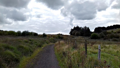
Looking forward on a rather inauspicious path...
... and then surprisingly the path becomes paved again as you enter the industrial remains of an abandoned colliery.
NOTEWORTHY
The Rhigos
I could continue to describe the ride, but honestly the pictures tell the story best. And this is a perfect segue over to the Gallery section of my blog. So take a moment to review the map... noting the climb and descent. One special and surprising issue that I discovered was that Rhigos Road (A4061) was actually closed for repaving over on the Hirwaun side. Other than the occasional service vehicle, I had the road to myself - all the way down to Treherbert. Fantastic!

Summary - Maerdy & Treherbert Tour
As I mentioned earlier, this was part 1 of 2; where I set out to explore the Rhondda Valleys. These valleys; the Rhondda Fach and Rhondda Fawr, are west of where I live and normally ride and are of equal notoriety for their role in the coal mining industry during the heydays of the Industrial Revolution.

There are two major mountain climbs of which I chose to divide across the two rides and two days: The Rhigos; which I covered here in this report. The following report covers the Blwch. Both are well known by cyclists in the UK and have been apart of the Tour of Britain many times in the past.

I've updated some of the content, particularly the Report Card (shown to the left) as well as appending some of the photos and notes.

Thanks as always for stopping by.

Cheers! - cm
Report Card
Ride Name: Maerdy & Treherbert
Start Date: Sat. Aug. 13, 2016
Starts in: Oakdale, Wales, GB
Departed: 8:14 AM
Distance: 67.7 mi / 108.95 km
Elevation: + 4628 / - 4629 ft
Max Grade: 25%
Duration: 10:27:14
Move Time: 06:29:37
Stop Time: 03:57:37
Max. Speed: 32.3 mph
Avg. Speed: 10.4 mph
Weather: clouds, sun
Temp: 19°c / 66°f


Ads Inside Post