Introduction

Welcome to the Archive. Here you'll find all of my ride reports from the first eight years of cycling in Wales. The layouts used here are in the previous design which I'm currently updating, so be sure check back!

Sunday, August 23, 2020

SOLITAIRE 
Magor & Wentwood Epic


It was a long day with a lot of climbing, but well worth the effort and quite possibly making this the ride of the year (so far!)
I enjoy exploring and a few weeks ago I happened upon a (new-to-me) backroad connection between Bishton and Magor. It's lovely and quiet and avoids the very dangerous A4810. Originally, I had planned to return from Magor via Redwick and the Gwent Levels, but having cycled through that area a couple of times this year, I wanted something different.

Then I recalled a ride I made with the Kingfishers a few years ago which heads from Magor up through Wentwood Forest and voila! I combined the two into one new and epic circular loop.(see: Wentwood Rewind)

Overview - Magor & Wentwood Epic
Distance: 70.4 miles
Elevation: + 4182 / - 4178 ft
Duration: 12:12:41
I've decided to divide this report into three distinct stages because; 1. it is very long and 2. each stage can be modified in the future without effecting the overall route. You may jump to a specific stage from the list below.


[ The map above is interactive! You may select a particular section to view the details. ]
My route touched upon several well-known cycle routes of the National Cycle Network which I've highlighted throughout the narrative. Additionally, I've inlcuded a list of those specific routes at the end of this report.

The majority of my ride was along quiet lanes where I could best avoid traffic. For closer inspection, I suggest enlarging the embedded maps via the links provided. Thanks again to Ride with GPS for their excellent maps. ▼ Jump to Summary
Preface
August 2020 has been a difficult month for cycling. We've had days upon days of rain. Just when I felt that I was in proper condition for a longer ride, we'd have another four or five days of lousy weather and I'd be stuck inside... getting out of shape again.

When I finally got out for a decent long ride I tried to make the most of it. I've included an enourmous amount of photos, sidebars, and general ramblings. So this may take some time to get through. Sit back, pour yourself another cup of coffee or tea or even pop open a beer. I hope you enjoy. Cheers! - cm
There she sits; my little caballo ready to go... just waiting for the rain to stop.

MAGOR & WENTWOOD EPIC
StageOakdale to Magor
Distance: 26.2 miles
Elevation: +965 ft / -1,693 ft
The morning looked dire, but the BBC weather forecast only clouds for the day. That was all I needed! Melanie packed my lunches, I loaded up my camera bag, and I was ready to rock & roll! ▲ Back to Overview
Getting down the mountain is fast and easy. Passing through the town of Newbridge at 8:00 am on a Sunday morning is always quiet, but during a pandemic; it's eerily quiet.
So yes, I can stop my bike in the middle of the road and take photos with little concern. I could hear a car coming long before I needed to move.
Following my photo exploration of Oakdale while on lockdown, I'm thinking more about the everyday parts of Wales; places I see on a regular basis. Many of these places go unrecorded because I pass through them so often.
This section is part of my ride to 14 Locks; a short and simple ride I often make to keep in shape.
Warts an' all
I often find myself explaining to folks in the UK (generally anyone who has not visited the US), that it ain't like what you see in the movies - far from it, in fact.
Hollywood has done an amazing job portraying romantic notions of the United States. So when I see my home country on the big screen, I often ask; "where in the hell is that?" It makes me laugh to an extent and it surprises me to hear folks ask why would I ever move to Wales?

South East Wales is fabulous. Firstly; the scenery is stunning. Every village is different and each valley has it's own unique look and feel. Interesting places are right at your doorstep. The Brecon Beacons are 20 miles north, while the Bristol Channel is 20 miles to the south. Everywhere you look and everywhere you go has something fascinating to see. Secondly, the people of Wales are charming.

So I've taken to showing Wales - warts an' all... because even the worst parts of Wales are better than most parts of America. Put that in yer pipe an' smoke it!
And what better place to start than with the Crumlin Arm of the Monmouth & Brecon Canal. This branch runs for nearly eight miles between Newport and Cwmcarn. I've entered just below Cwmcarn at the Pontywaun car park.
It's impossible to cycle along the canal and NOT take any pictures, especially when it looks as lush and green as this. By the way, this is also NCN Route 47 of the National Cycle Netowrk.
The leaves are still wet from the morning dew and the air is mixed with the musty smell of things rotting at the canal's edge and water lillies.
Further down the path is Fourteen Locks, a famous historical junction where the path drops over 200 feet within a half mile (hence the name). There's a great little visitor centre and cafe which serves as an anchor spot for many walkers and cyclists alike.
Previously, this section was a combination of rough gravel and dirt, i.e.; rocks and mud, making it frightening to cycle down and a beast to climb up. Now it's wonderful, if not a little speedy (that's a 10% decline, btw...) Woohooooooo!
Coming into Newport is quite a change. Just as you reach the riverfront you pass the castle which seems all but forgotten. It's fenced off from the public and appears sad and in the way as both the train and several busy roads surround it with little notice.
On the otherhand, the Riverfront is quite nice and undergoing extensive development. Ten years ago it was rather rough and seedy along here. Now there are shops and housing, movie theatres and schools, an art centre, and even a large new shopping complex called Friars Walk.
The unusual white bridge in the photo above connects the east and west banks of the river Usk. Designed to represent the loading cranes which once lined the docks along here, it's sole purpose is for pedestrian and cycle traffic. The two photos below are taken from the center of the bridge looking north and south, respectively.
Leaving Newport along the A48 is rather surprising... there are wide walking and cycling paths on both sides of the busy roadway. It's an unusual feature that is very convenient. Yet, it's odd to be cycling along a dual carriageway.
Addditionally, there are underpasses which make crossing to the other side of the roadway extremely easy and safe (photo above). And it's family friendly for the short distance it follows the roadway (photo below).
Then after a mile or so I turn off toward the village of Llanwern.
This is why I chose this route. To see this road again. To take my time, to stop, to reflect... because this part of Wales reminds me of North Carolina.
I remember vividly, being just a boy of nine or ten and riding in my grandmother's car along the backroads of Davidson County. We had the windows down just after it had rained, snaking along through the country, passing old tobacco barns burried deep in the woods, creeks gurgling, dark and mysterious. I can smell it now, just as it was then... rotting wood and the dampness at dusk, the sun low through the trees. The pulsing buzz of cicadas and tree frogs - on and off and on again.
She had a 1965 Chevrolet Impala, 4-door. Big and black with a shiny red vinyl interior. She didn't drive fast because the car was nearly as wide as the road and you never knew what might be around the corner. No rush anyway... we were just going home.

We didn't talk much, a casual comment about this or that. I was looking out the side window, watching it all pass. The woods were green and lush with undergrowth. Ferns lapped over tin cans, broken glass, and a dead bird pasted along the edge of the road, the feathers of a wing standing up at a right angle. Tires splashing wet... ssshhhh-ssshhhh-ssshhh.
I remember how slow everything seemed when I was young. Folks would say; "Take your time... ain't no rush". And yet it all went by so quickly.
Saint Cadwaladr's Church sits on a small rise just as you enter Biston. This little church has an interesting story behind it's dedication as Cadwaladr was the last Welsh ruler to call himself King of Britain. (see: Cadwaladr)
There are train tracks just to the left, but there isn't a station in the village. Trains fly past on their way bewtween Bristol and Newport. Passengers can only catch a glimpse of the area. Perhaps the folks that live here like it that way.
My rides are solitary events. I ride some and stop. I just stand and look, listen. I can hear a train approaching behind me, a brief toot of it's horn as it passes the crossing, and then it's gone. Now it's quiet again. Somewhere deep in the overgrowth water is gurgling. A blackbird calls out.
Being out on the road all day is cathartic. I toss away the nonsense and realise what is important. I focus.
This unassuming service road into an industrial estate led me to discover an abandoned road running behind the Tescos distribution centre.
And for just about a mile I was in another world, yet again... I ride slowly.
At the end of the service road, I re-enter civilisation (too soon!) and I am greeted by a couple of lovely local girls. Hello ponies!
This is the A4810; a very dangerous road. I've read of more than one cycling fatality along here. On the other side, however; a quiet lane leads into the village of Magor.
Magor is a sleepy village even on a busy day, but with the pandemic it's a ghost town. It's quite charming though; the architecture along the square is modest but look at all the flowers!
On the other side of the high street stands the remains of the Procurator's House. The ruins date back to the 16th Century. I've traveled 27 miles to this point - not quite half-way, but far enough to stop for lunch. I had a sandwich (thank you Melanie!) and took a couple of bike shots before heading off.
For anyone interested, the Dawes Heritage Cycles Facebook group has some wonderful classic Dawes bicycles to gaze upon. It's a blackhole of loveliness.
MAGOR & WENTWOOD EPIC
StageMagor to Usk
Distance: 18.6 miles
Elevation: +1426 ft / -1398 ft
I leave Magor heading north along St. Brides Road; first crossing the B4245 and then slipping under the M4. This is a wonderful little lane with some lovely views through the small valley leading past St. Briged's Church. ▲ Back to Overview
There has to be a story behind this twisted tree.
I'll be the first to admit that perhaps I include too many photographs in my reports. I stop often and look around. Not everything is terribly exciting, but I find it interesting to study the details. And I hate looking back over my images after I have returned home and thinking I should have photographed something.
Case in point; the two photos above. I took over 20 different shots of this landscape, trying different angles etc. because I was so impressed with the view. I've only included two here, but I think you get my point.

Then I reached St. Brigid's Church at St. Brides Netherwent. I hadn't cycled more than two miles from Magor before I was off my bike again. I spent nearly an hour wandering around the church grounds. Also of note: I didn't know at the time that this is the site of an deserted medieval village (DMV), so I'll have to return to look for the remains! (Wales is so friggin' interesting!)
Before I got much further though, I had to make a brief stop. The farm boy in me loves the smell of a freshly plowed or harrowed field. This farmer has done an excellent job. Driving a heavy tractor across a large field such as this and hardly leaving any tyre marks takes great skill. I am mightily impressed!
A mile up the road and I meet the junction of St. Brides Road and the A48. This was once known as the "London Road".
There is a popular restaurant here which has quite a history; the Rock & Fountain. Also, to my left, high on the hill sits Penhow Castle.
The Rock & Fountain Inn
The Rock & Fountain Inn was once a very busy coaching inn during the 17th-century. It provided food, drink, as well as much needed rest for travelers. The large attached stables also served as an important stopping point to change teams of horses for coaches on their way to Newport.
Additionally, the stables of the Rock & Fountain served Penhow Castle; once belonging to the Duke of Somerset during the 1700's. By 1868 however, the inn had been converted into a pub which has since changed ownership numerous times over the last 150 years to what we see today; a steak house.
Copyright Jaggery

Penhow Castle
Penhow Castle is quite unusual because for one; it is privately owned AND secondly, it is still a private residence. It is in fact, a fortified manor house, but often said to be the oldest inhabited castle in Wales. It has an extensive history going back to before the Norman Conquest! (See the link below for more info.)
Photo Andrew Tivenan
As I am writing this, I am sat at home. It's been a week since my ride and I've been doing research on the area - something I wish I had done before, but nevertheless, now that I've discovered these bits of history, I have more reasons to return.
Photo Andrew Tivenan
Here's a photo from Google Maps to give you an idea of the area.
One last bit of history and then I'll let you go... I stumbled across the records of John Ogilby who is said to have published the first road maps of the UK in 1675. (Another black hole to fall into whilst surfing the Internet.) Check out the plate below. It lists this location along the road to Newport.
Read more: South Wales Argus; "Rambles in Gwent", Castle of Wales; Penhow Castle, and 16th and 17th-century Mapping-of Wales, Penhow Castle at ecastles.com
I was across the road and behind the Rock & Fountain when I took the two shots shown below. I didn't know precisely what I was photographing, but they looked interesting.
As it turns out, I had inadvertantly discovered The Church of St. John the Baptist Penhow (above) and Penhow Castle (below).
Just a short distance ahead and sitting along the old turnpike road is the remodeled tollhouse with some very charming attached cottages.
Looking around back you can see that they have wonderfully cute little gardens!
And then the climb begins up into Wentwood Forest. It's not terribly steep at the start... just a 7% - 8% incline. And I love finding little hidden gems along the lanes like this lime kiln... just sitting there, unused for probably 100 years or more.
And it begins to get a little steeper as I approach the reservoir... now at about 10% - 12%. They've drained the reservoir to work on the tower... which is something you don't see very often. (Read more at: Siltbuster)
I'm not a morbid person, but I stumbled across this article looking for info on the reservoir; "Mudered Woman Found Tied to Sink". I'm glad they found her, but geez...

On that sobering note... let's return to our journey. After photographing the reservoir, the climb up into Wentwood Forest began in earnest. I was hitting 14% and 16% gradients. It's tough going, but to be honest - I love finding these dark and narrow lanes deep in the woods.
It's just a tad over a mile from the reservoir to Usk Road where I stopped at Caderra Beeches car park in Wentwood Forest for a much needed rest. I've only traveled seven miles from Magor, but the last two miles were tough.

I haven't explored this area much because of the climb to get here and it's rather remote. There are few roads through the forest and it is as much a mountain as it is a woodland, but it is stunning and the history of Wentwood is fascinating.
The cark park is full and hikers are crawling all over the place. People are looking at me oddly. A man asks if I rode my bike all the way up here. When I say yes, he shakes his head and says; "It's a long climb". I laugh and agree.

A quick bit of bike porn and I'm off again, racing like the wind downhill. The road is wide with long sweeping curves so that I can see clearly and I just let her rip!

"There is no glory in cycling downhill, but it can be glorious." - me
Approximately halfway down the hill the road levels for a few hundred yards. I stopped here because if I continued on I would be heading down an incredibly steep hill... so steep that I avoid it. (I just don't enjoy braking that hard and for so long.)

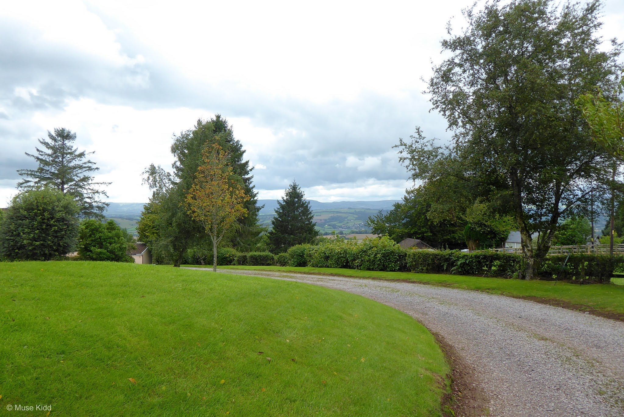
Looking across this driveway. You can see the height of the ridge.
The road to my right is named "Old Road" and you guessed it... that's the way to go!
A mile of so down "Old Road" the trees open up and I can see across the fields on my right-hand side. That's the Severn River far off in the distance (I'm guessing it's at least 10 miles away as a crow flys...).
Meanwhile, I've got another mile of rolling lane... isolated, remote, and quiet.
Which leads to the juction of B4235. It's a somewhat busy road at the wrong times, but during the middle of a weekday, it's fine.
Before I get started, it's the perfect place to take a break and say hello to the girls. They are friendly and charming and seem to have their own unique personalities. How can ya not smile when you see that face? Read more at: Amazing Alpacas.
Then its another speedy run down the mountain toward Llangwm. It's long and sweeping and loads of fun to just let your bike do her thing.
This was once a thick forest, but they've been logging the hillside to the right and now you can see across the valley toward Raglan. It was especially nice when the trees were tall along both sides. Then it was a deep and dark wooded road. Now they've changed the entire feel - I hope they don't log the otherside.
My goal is to reach Usk for my next break; however, I turn off the B4235 as it gets busy closer to town. I discoverd this small lane whilst poking around on Google Maps and it looked interesting. It's time to explore!
Not far down the lane I discovered this lovely little church AND an organisation I had not hear of before: "Friends of the the Friendless Churches". How wonderful!
It's starting to get late in the afternoon and I'm slowing down. The light is nice so I decide to take a break outside of Usk (social distancing and Covid-19 considerations). I've cycled 44 miles so far and I've perhaps another 25 to reach home.

MAGOR & WENTWOOD EPIC
StageUsk to Oakdale
Distance: 25.6 miles
Elevation: +1,791 ft / -1,087 ft
I passed through Usk with merely a nod. I've been in this town many times and taken plenty of photos. (See: My Gallery - Usk.) By this time I had been cycling for nearly nine hours. I was beginning to fade and thinking of home. ▲ Back to Overview
It is a short ride out to Monkswood on the very busy A472 (a road I generally avoid), but I turned off after a couple of miles and began climbing up the lovely little lane toward Goytre Wharf. I could have/should have shot more photos though...
But of course, my camera comes out when I reach the Monmouth & Brecon Canal again. This section happens to be the eastern branch which runs bewtween Brecon and Newport. I'm sure that I've photographed this section a dozen times.

This also happens to be NCN Route 49 of the National Cycle Network!
As I approached Pontymoile Boat Basin, my photography became almost rote. I saw something beautiful, yet again... I took a photograph. In my tiredness, I lost patience and I didn't make any compensations for the changing light.
But lordy, it was pretty.
It's five easy miles along the canal from Goytre Wharf to Pontymoile Boat Basin. I've cycled nearly 58 miles with approximatley 12-13 left ahead of me.
Just after crossing the Afon Lwyd River, I climb off the canal path and into Pontypool Park (passing through the fabulous "Sally Gates"!) From here I'll make my way through town to join NCN Route 466 along the road to Llanhilleth.
The route is relaltively quiet and non-descript for about three miles until just before the road ends where it passes my favourite spaceship at Hafodyrynys. The route then moves onto a traffic-free section for the next mile or so.
I'm nearing home now. I can see across the Ebbw Valley to the opposite hillside where Crumlin sits at the bottom whilst Treowen is above it in the distance. Oakdale is just over the hill.
I snaked. I climbed. I pedaled my way home tired to the bone. It had been an enormous ride. I took one last photo as I crossed the Chartist Bridge leaving Blackwood into Oakdale. I cannot say that I've seen it empty many times... this pandemic effect.

Summary - Magor & Wentwood Epic
It was a great, great day and fantastic adventure. I love the new connector I've discovered between Bishton and Magor. The ride up through Wentwood was good, but very difficult.

The weather was perfect. Great temps between 13° and 16° with little to no wind. I just rode and took my time, stopping often to explore and take photographs... just what I like most. This was definitely the best ride I've had this year.

Thanks as always for stopping by.

Cheers! - cm
Relevant Links  
Report Card
Ride Name: Magor & Wentwood
Start Date: Mon. Aug. 23, 2020
Starts in: Oakdale, Wales, GB
Departed: 8:17 am
Distance: 72.5 mi / 116.68 km
Elevation: + 4431 / - 4430 ft
Max Grade: 14.0%
Duration: 12:12:41
Move Time: 07:20:22
Stop Time: 04:52:19
Max. Speed: 33.1 mph
Avg. Speed: 9.9 mph
Weather: cloudy, lt. rain
Temp: 16°c / 61°f

Ads Inside Post