

Elevation: + 2369 / - 2368 ft
Duration: 08:02:28
The castle is located just above Merthyr Tydfil outside the village of Pant and at less than 20 miles it's not far from our home. I wanted to make a day of it, so I loaded my clunky old Sony camera along with an assortment of gear and took off. I was hoping to take some better photographs than what I had found online. Plus, I had a crazy notion to brew a pot of coffee in the dungeon!
NCN Routes 467 & 46
For the first part of my ride I followed NCN Route 467 up the Sirhowy Valley to the town of Tredegar. It's a fairly short cycle route that's always quiet and scenic. Of course, this valley holds a special charm because it's where we live.

There's a viaduct across the valley that they filled in some time ago. You can barely make it out if you look closely. Friends and I hiked along the trail on the other side a few years ago and we could hardly tell when we were standing right on top of it.

That's the "Old Man of Sirhowy" (as I call him); for he makes me think of Robert Payne back in North Carolina hiking the trails of the Blue Ridge Mountains. Cheers Rob! You're a good man.

The traffic-free part of the route is interrupted at Hollybush where you have to get on the main road (A4068/Newport Road) for a couple of miles to Pouchin. It can be very busy during rush hour, but after 9:30 am, the traffic falls off significantly. Once on the road, the valley widens for a short while offering some spectacular views.

I've asked lots of people why this old school still sits here along the road. It's kinda interesting, but nothing really special. However, Wales is like this... there are many things just laying around, lost to time - which merely enhance the country's character.
Just past the school is the village of Pouchin where NCN Route 467 becomes traffic-free again as you travel up to Georgetown. From there it's a shared-use path that closely follows along side the main road for the last couple of miles into Tredegar.

Once I was above Tredegar, I stopped for a short break in Parc Bryn Bach. It's a 340 acre park with extensive facilities, loads of seasonal activities, and even camping! It's often crowded during the summer with folks renting boats, fishing, having picnics, and just strolling around the lake. Again, I was early so hardly anyone was about. The smell of a cooked breakfast was a tempting distraction as I left the visitor centre cafe.
The park itself was once a scarred landscape from the massive colliery that operated here. But to look at it now, it's impossible to visualise any sort of heavy industry. Many thanks to the Coalfields Regeneration Trust which is doing a fantastic job to restore and revitalise this lovely country.
Leaving the park, NCN Route 467 ends at the junction with NCN Route 46. From there I turned west across the Heads of the Valley toward the village of Dowlais.

Along the way and just above Bute Town you encounter an unusual bit of sculpture; The Twisted Chimney / Simnai Dirdro, which at first glance one would think is some impressive brick work. However, on closer inspection, you discover that it's a clever bit of trompe-l'œil. That's right!... the darn thing is made of preformed plastic! It looks cool enough for a photo op, but personally, I find it a little disappointing.


One last shot looking down Rhymney Valley. It's a grey day, but the temperature is mild for March. The trees are starting to bud and daffodils are scattered everywhere. It's great to be out.
Morlais Castle
North of Merthyr Tydfil, past Dowlais and the sleepy village of Pant is Morlais Castle. It's not visible from the road; however, it can be easily reached via Morlais Castle Golf Club. I suggest stopping at the clubhouse and asking permission before crossing any fairways. (They were more than happy when I inquired, giving me directions, etc.)
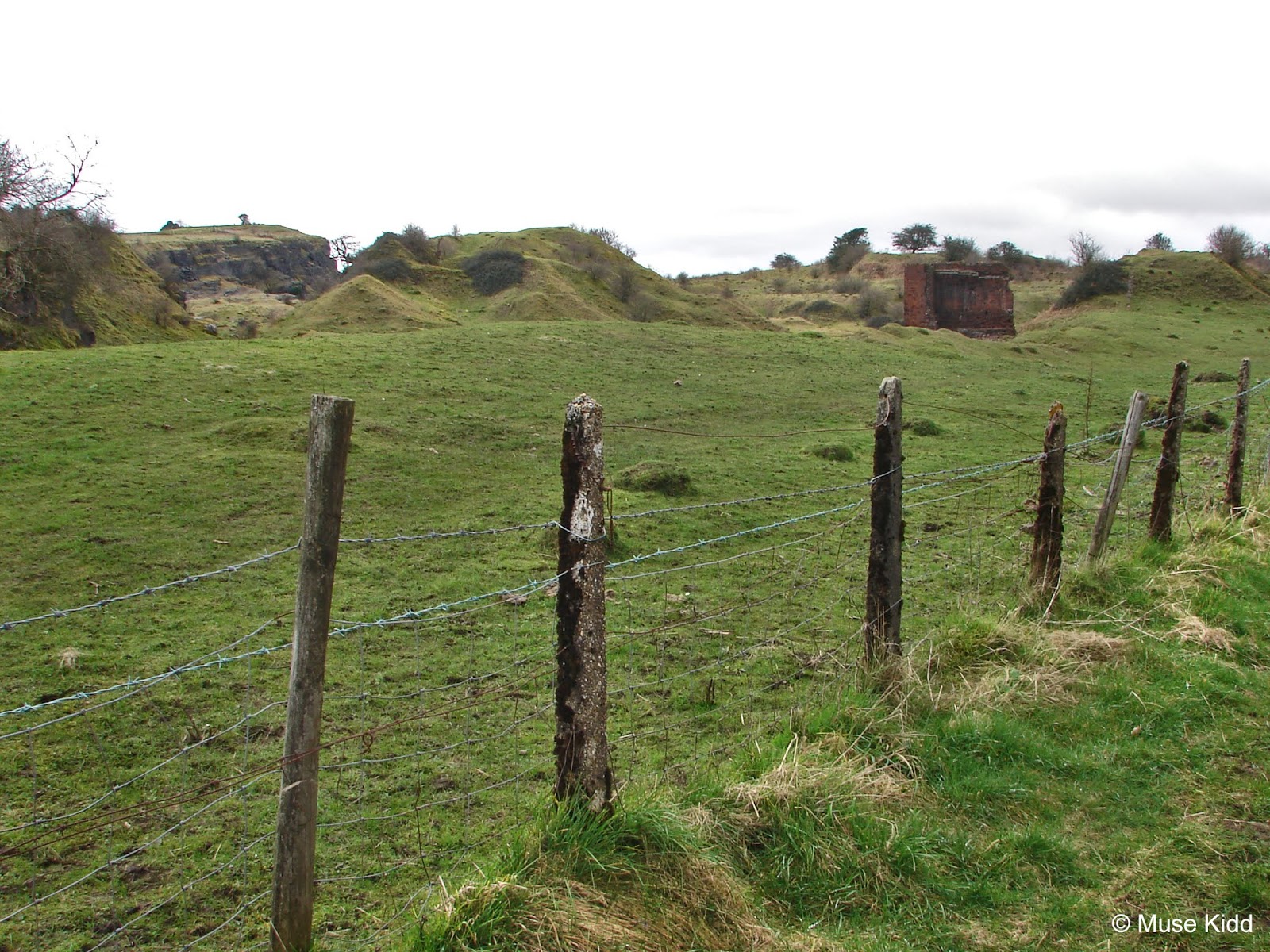
Note: Access to the castle can also be reached from below. There's a car park along an unnamed road leading from Pontsarn, southwest of Pant. Across from the car park there's an unpaved track leading to the abandoned tin works and quarry. The castle sits above all of this and in my estimation, it's quite a bit more of a climb.

Flying golfballs were not something I had considered when preparing for my journey; however, the golfers were very friendly and waved me through with great smiles. Most were interested in my journey, asking questions about my gear and travel distance. Of course, when they heard my accent, it opened the flood gates of inquires!

Climbing up through the "rough" past the fairway was pretty difficult. The ground was extremely knobby with tall grass and surprisingly deep holes sometimes filled with water. I had to lift the front wheel and drag the bike to get through. It was at this point that I laid the bike down to catch my breath cuz' I was knackered!

Crossing yet another fairway I was met with a barbed wire fence and stile. Opposite was the moat and castle. I decided to leave the bike by the stile whilst I explored further on foot.

Heading up the hill toward what looks like an entrance of sorts leads onto the inner courtyard of the castle. At first there doesn't seem to be much up here. Mounds of rock are all that's left of the ramparts. The views are wide and clear on all sides.

Directly across from the gate lies an unusually large hole. Often referred to as a well; it was most likely to have been a cistern. There's definitely some decorative architecture down there. Why would anyone decorate the inside of a well?


Off to the left at the far end of the courtyard is an pointed doorway peering out of a large mound. This was the motte where the main tower once stood.


The doorway then leads to an underground vaulted chamber commonly called "The Dungeon". This is the last remaining bit of architecture to be found of the castle, yet it suggests that the castle must have had a good deal of grandeur at one time.

Kinda spooky, but super cool! And yes, I said I was going to brew some coffee in here, but to be honest it was very wet and muddy inside. I'll look for a better spot.


Standing atop the tower base looking out over the courtyard gives you a better idea of how the castle was once laid out. You can easily make out ridges along the ground indicating where walls and buildings once stood. From here too you can see "The Gate" and "The Well".


Me thinks this is the perfect place to have my lunch.

There's nothing but the wind and the valley beneath me. I'm at the highest point facing south down the Taf Fechan Valley.

Behind me, the peaks of the Brecon Beacons are shrouded in clouds.

| NOTEWORTHY SIDEBAR
Morlais Castle - A Brief History
|


Following my lunch, I explored more. A ditch runs along three sides of the castle. Directly below the south tower, the ditch becomes a severe cut straight down into the limestone - like a giant slot cut 20 feet deep and at least 40 feet wide into solid rock. It is an impressive bit of work.


Along the western edge the land suddenly drops away to the base of a quarry. One misstep and you'd be falling several hundred feet to an undesirable climax to your day. There are no safety features to protect you from being stupid.


Standing at the edge of the ditch and looking up to where the south tower once stood. It's not hard to imagine that if you survived the fight across the ditch you must now charge up this hill and fight again. Urgh!


How many men died in this ditch? How much blood soaked the ground where I now stand? Wielding shield and sword, fighting for a baron or a king, fighting for country, for home, for family, or for the last moment of your life?


It's peaceful here now. Red kites drift low overhead, an upwind lifts their wings effortlessly, their nests sit undisturbed in the bare stone walls of the quarry below.


Slowly I make my way around the edge coming back toward where I started. The rubble at my feet is unremarkable; broken shapes of rock. I look for some semblance of a stone cut to fit a building... a sense of purpose. There's nothing but detritus.


The narrow path I follow along a rickety fence is littered with the droppings of the new inhabitants. A stile defends my bike.

Looking back I think that there's not much left to deteriorate. Who will come here next to lay witness to the past? It will probably look like this for another 500 years... so much history that's now just a pile of rocks.
NCN Route 8 / Taff Trail
The ride home...
Crossing the fairways, leaving the castle behind, exiting the golf course puts me back into civilisation of sorts. Across the road is a vent for a tunnel running underneath us; a remnant of the Victorians in their railroad heyday and I'm thrown forward in time to another past.


I picture medieval knights riding horses past men cutting blocks of stone; building railroads for the Industrial Age. Ghosts from ages long gone wondering about each other and how they got here... castles and viaducts.


A cold wind blows in with the clouds as I cycle the short distance past Brecon Railroad, up the valley toward Pontsticill Reservoir, then left onto NCN Route 8; the Taff Trail. It's all downhill now. I could glide all the way to Cardiff Bay on another day.


Solemness washes over me as I prepare to head home. The vast history and dramatic landscape is intoxicating. I am so very fortunate to be able to explore this wonderful country by bicycle.

Buried deep in the overgrowth off to my left is the entrance to the railroad tunnel that runs to Pant for which I passed the vent earlier.

Crossing over the Pontsarn Viaduct just south of Vaynor I pause to reflect on the battle that took place in the valley below... nearly 800 years ago. In case ya missed it, check out: Madag Ap Llywelyn. Aside from having a perfect name for a warrior, he lived up to it. See also: Madog ap Llywelyn’s uprising against Edward Longshanks


There she sits. High up on the mountain lay the remains of Morlais Castle. It must have been an imposing and spectacular site to behold when the towers and ramparts were standing. I cannot imagine it.

And in my best Tommy Cooper voice; "just like that..." I'm in Merthyr Tydfil. Snaking across the road I am tempted again with the smells of onions and a hot meal. But I must carry on! I have many miles to pedal to reach my home.


It's wide and sweeping, but ya gotta stop and lean over the side to get the full impact of the Cefn Viaduct. Also, NCN Route 46 ducks under and carries on west from here.


Meanwhile... I glide on. Rolling silently behind gardens of laundry and sleeping cats. A valley landscape unseen by cars and trains.


The roar of cars is replaced by the splash of the River Taff as it jumps along a narrow bend. Climbing over The Works Bridge in Pontygwaith leads up to the Trevethick Trail section of NCN Route 8, also the junction of NCN Route 477.


Wide, gentle, and looking lovely.


Muddy, bumpy, and very cool!


This section of the Trevethick Trail snakes above the Taff River for two miles, from Pontygwaith to Quakers Yard. An anglers club maintains this wildlife area. Kingfisher and otter are common.

The original stone sleepers are still visible along lengths of the old tramway and a stone embankment lines the eastern wall for most of the way. (Check out my write up on this section at Ride with GPS: "Trevethick Trail")


Remnants of old viaducts hover along the hillside whilst the trains rumble over one still in use today. It's a surprising find where you have to stop and just look.


But the day is gating late... the sun is quickly setting and I've over 10 miles to reach home! I gotta keep moving. (One last look at the River Taff...)


NCN Route 47
At Quakers Yard I leave NCN Route 8 (Taff Trail) for the last leg of my journey and join NCN Route 47 heading east to Treharris. Tucked up in the woods there's one of the few switchbacks in the area. It's still rather steep, but a huge help getting up to the top of the hill into Trelewis.

Then there's this lovely little bridge crossing over the Bargoed Taf River. NCN Route 476 branches off to the wonderful Parc Taf Bargoed on the opposite side. I don't know of any other area in Wales with so many cycle routes so closely linked.


Before you can blink, you're out of Trelewis heading along a very unusual section of cycle path for Wales... it's flat! Ha!


That's right. You've got over four miles of (nearly) flat miles to cycle. This is Parc Penalta of the Three Parks Trail which runs between Sirhowy Park in Crosskeys to Parc Taf Bargoed.


There's an old rail spur heading north... waiting for Sustrans perhaps?

The route leaves Parc Penalta and snakes along through the woods a short distance to Hengoed where it crosses the stately Hengoed Viaduct.

At the far end of the viaduct is one of the most notable public sculptures to be found along the cycle paths in Wales; The Wheel O Drams.

Then I'm back on the road heading through Ponllanfraith and Blackwood, crossing the Sirhowy River again and climbing one last hill to home.
Despite being mostly overcast, the day was warm and dry. It was another perfect day of cycling in this lovely little country I call home.
I hope you enjoyed this report. Thanks for taking the time to visit my site...
Cheers! - cm
|
|
| Ride Name: | Morlais Castle | ||
| Start Date: | Thur. Mar. 21, 2019 | ||
| Starts in: | Oakdale, Wales, GB | ||
| Departed: | 10:52 AM | ||
| Distance: | 45.6 mi / 73.4 km | ||
| Elevation: | + 2369 / - 2368 ft | ||
| Max Grade: | 9.5% | ||
| Duration: | 08:02:28 | ||
| Move Time: | 04:35:16 | ||
| Stop Time: | 03:27:12 | ||
| Max. Speed: | 31.0 mph | ||
| Avg. Speed: | 9.9 mph | ||
| Weather: | overcast | ||
| Temp: | 13°c / 55°f | ||
 |
|
The following NCN routes were used in part or in whole:
|
▲ Back to top