The plan was simple; go for an epic ride. I wanted a long distance ride with big climbs. This ride became one of my all-time biggest.
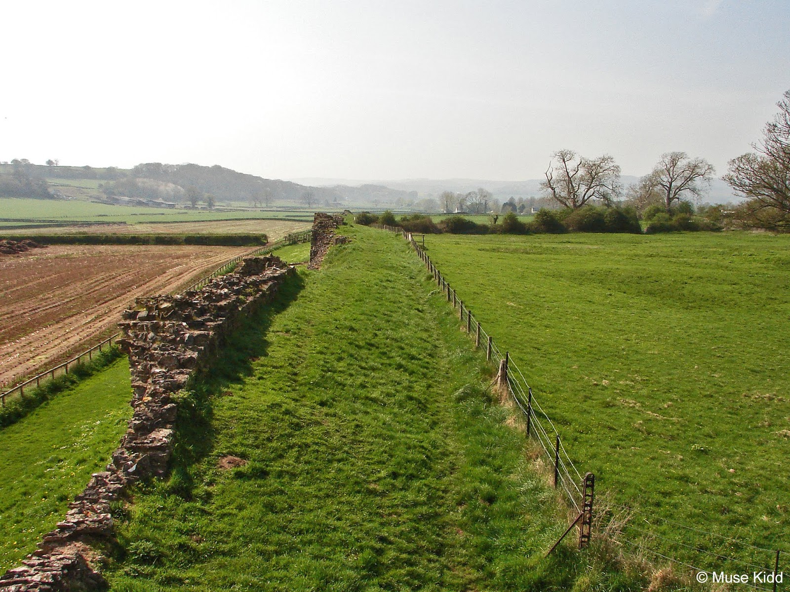
 |
| Mid-afternoon, cruising along the lane from Skinfrith. |
The weather has been mostly crap this year. It's been very rare to have a day without rain. I just wanted to relax and enjoy a full day of cycling... to take my time. So I set out an ambitious goal for myself which became much, much longer as I also tried to photograph the entire route. In turn, it has taken on an enormous amount of time to edit and write this report.
Note: This ride was long. And now, so is the report. Originally written in three seperate installments, I've gone back (after much deliberation) and merged the three into one massive report. My hope is that this will simplify navigation.
Elevation: + 7886 / - 7896 ft
Duration: 16:50:11
Stage
Stage
Stage
Stage
Stage
Elevation: +1,715 ft / -2,179 ft
At Beaufort I had a couple of choices: I could keep heading east along the Heads of the Valleys (NCN Route 46) and drop down through Clydach Gorge or I could turn north on Llangynidr Rd. Both are wonderful routes, but this morning I felt the need to see some "Cowboy Country" (as my wife calls it). So I was off through Llnagynidr Commons again. YaaaHOOOO!


I have to admit that this area is simply stunning. You've got the Black Mountains to your right (east) and the Brecon Beacons looming up straight in front of you (north). I've shot loads of photos here previously for I simply cannot ride through without photographing it.


The tricky part of photographing the same route multiple times is trying to capture something new - a different angle. I'm getting a little tired of my typical "road" shot. They're necessary to writing about cycle routes, but I need to make them a bit more varied. I want to make them more interesting.
 |
| I kinda like this one... |
"Cowboy Country" was surprisingly chilly this morning at 2° and very windy. I was worried that the photos would be blurry. In fact, I had to get off the bike to steady myself for most all of these shots.


As it turned out, laying the bike down and wandering around helped me find some interesting new angles... looking at familiar places from different viewpoints. Although the wind was howling and it was cold as bejeezus!
Note: For more images of "Cowboy Country", visit my gallery; Llangynidr Commons.

It's a crazy fast ride down to the village of Llangynidr; three miles at well over 30 mph and I was FREEZING! But once at the bottom the temperature warmed up significantly and then it was an easy cruise along Cwm Crawnon Rd (B4558) for four miles to Crickhowell. I've made a sidebar for this short section just because it's so lovely.
| MINI GALLERY
Cwm Crawnon Road
    |
You cannot help but gaze whilst riding along. And again, I found it worthwhile to stop, get off the bike and wander. Poking my head through the hedge I found these lovely images along the canal.


Then I'm over the bridge at Crickhowell. I've cycled 25 miles thus far and I've completed the first section of the day. It's time for a break.


It was at this point that I discoverd the memory card in my camera was full. Shocking! Urgh! It was doing quite well and I was excited to use it for the entire day. I had a cup of coffee and a brownie at a local shop whilst I thought this dilima through (...failing to photograph that as well!) Double-urgh!
Stage
Elevation: +1826 / -1774 ft
Leaving out of Crickhowell the route starts steeply on a tiny lane heading over a ridge to the quaint village of Llangenny at the River Grwyney.
 |
| Doesn't look like a 14% grade from this shot? |

I continued on this lane following the river over a series of short hills and descents for nearly nine miles, slowly making my way around the north-western side of Sugarloaf Mountain. Some climbs are gentle, some are rather harsh. All of it is stunning.


This is not a common route for cyclists and in all honesty, I’ve hardly ever seen another cyclist on it. (This feature makes it that much more special to me.)


And it’s quiet… seriously quiet; for there are no other roads about. This narrow valley is nestled deep in the Brecon Beacons and feels completely disconnected from the rest of the world. You can hear a car or tractor coming along the road from very far off.

 |
| The old schoolhouse is now a private residence. |
And there's loads of farm life; from hundreds of sheep grazing over wide hillsides, to small herds of cows fenced in grassy paddocks, to many, many horses poking their heads out of stable doors, squawking chickens wandering by the roadside, plus squirrels, ducks, pheasants, rabbits, and don’t be surprised by llamas, alpacas, and even an ostrich or two.


This area is characterised by two styles: working farms that appear to have been in the same family for hundreds of years and newly re=purposed "play-farms" for the fashionably-wealthy. They are all stunning with ancient bits of architecture scattered over landscapes both natural and highly manicured.


The valley widens as I head down to cross the main road north out of Abergavenny (A465). Here I joined NCN Route 46 again and started working my way up the small lane past St. Teilo's Church. (photo needed!) I'll be leaving the Brecon Beacons soon.
 |
| Almost to the top... |


I had to climb for several several miles before reaching the high ridge that leads me out of the Brecon Beacons. I was on this route (and ridge) all the way to Grosmont.


 |
| Photo-bombed by a chicken! |

The views are spectacular on both sides of this "saddleback". It's a bit windy, but the easy pedaling is very welcome after a lengthy climb.

It’s another fast descent into the tiny village of Grosmont and if you don’t brake hard, you’ll just zip right on through. I've just completed Section Two of my ride with a total of 45 miles. It's time to take another break. Time for food, check my maps, and re-group. So I sat outside the castle, took some photos, and had my first sandwich of the day. Thanks Melanie!
| MINI GALLERY
Grosmont Castle
    |
The village of Grosmont seems to be clinging to the side of the mountain. Everything seems to be sitting at odd angles. It's quirky and cute and feels very cozy.


Along with the exceptional Norman castle and church, it’s well worth poking around the village. The Angel Inn is a great place to have lunch, a pint, and meet the locals. Everyone says hello.


It's also good to walk around a bit to stretch your legs, because the ride to Monmouth is quite a workout with four significant climbs. It's lovely. It's long. It will leave you breathless.
Stage
Elevation: +1143 / -1432 ft
Leaving out of Grosmont starts down an insanely steep but short ride to the bridge crossing of the Monnow River. On the other side; I enter England! It is exceptionally lovely and well worth stopping to catch your breath and look upon the classic British countryside of the Monnow Valley.


Just past the bridge is the junction of NCN Routes 46 and 426 at Kentchurch. NCN Route 426 runs between Kentchurch and Skenfrith and is NOT well marked. (I didn't even know I was on a cycle route until I got home and found it on the Sustrans map!)
Of course, there is also Kentchurch Court. The house is open by appointment only whilst the gardens are open to the public between 11 am - 5 pm.


But despite the road getting increasingly difficult, it's a gorgeous route. I tell myself that it's okay to go slowly and take my time. It's okay to stop. To enjoy the ride.


Then in the distance, of to my right is an unusual looking church. It's actually a fortified church and you'd miss it if you didn't look closely or know better.
| MINI GALLERY
St. Michael's Church - Garway
  |


And then suddenly I'm riding down through a densely wooded lane and into the village of Skenfrith. This is another good place to take a break, have a snack, and recoup. There's another hard eight miles to Monmouth, so it's good to stretch my legs and check out the castle!
| MINI GALLERY
Skinfrith Castle
    |
From Skenfrith, the first climb is a very long and very steep and very narrow lane which in-turn begins a series of long and steep climbs (and descents!)... all the way to Rockfield. It's a beautiful ride along the Monnow River, but it's particularly demanding.


Just before Rockfield, I joined the main road (B437) where traffic picked up a bit and before I knew it; I was racing into Monmouth. Time for another well-deserved break.

I generally stop by the iconic Tower Bridge for lunch. There are picnic tables along side the river and it's a lovely spot. Folks have been picnicing here for 800 years.
The route leaves Monmouth on the A466 down to Tintern and Chepstow, which I've covered extensively in Monmouth & Chepstow Classic. Here are a few highlights.
| MINI GALLERY
Monmouth to Tintern
        |
Stage
Elevation: +1,463 ft / -1,488 ft
Then it's a classic climb out of Tintern; three steady miles up and up and up. It's not really that difficult, it's just steady. But boy, oh boy, do you see cyclists racing down the other direction! It was at this point when the sun started to shine and the day began warming up considerably.


At Chepstow I joined NCN Route 4 heading west (the Celtic Trail). This route will lead me all the way back to Newport. For the first part I rode on quiet lanes winding my way through some lovely working farms down to Caldicot and the Gwent Levels.


It's a shady ride down some narrow and rather steep lanes to reach the sleepy village of Mouton. Oddly enough too, this little junction has several options. This junction shows how important it is to have a good map. I don't think any of these signs are pointing in the correct direction!


It's lovely and quiet and deep in the valley which inevitably means that it's going to be a climb to get out! Fortunately enough, it's shaded and cool so I can take my time.


And it gets crazy beautiful again... in yet another style. I may have gone overboard with the number photos for this section, but I'll not make any apologies. I love this part for it reminds me of North Carolina when I was growing up.


The sun was out fully now and the air was full of buzzing insects and the smell of rape seed. This is summer in Wales.


Simply magical.


And then I was out of the country and riding along side a busy dual-carriageway heading into Caerwent.

| MINI GALLERY
Caerwent
    |
It's then a very short ride to Caldicot where I'll take another break. It's late in the afternoon, it's gotten quite warm, and everything is slowing down.


Stage
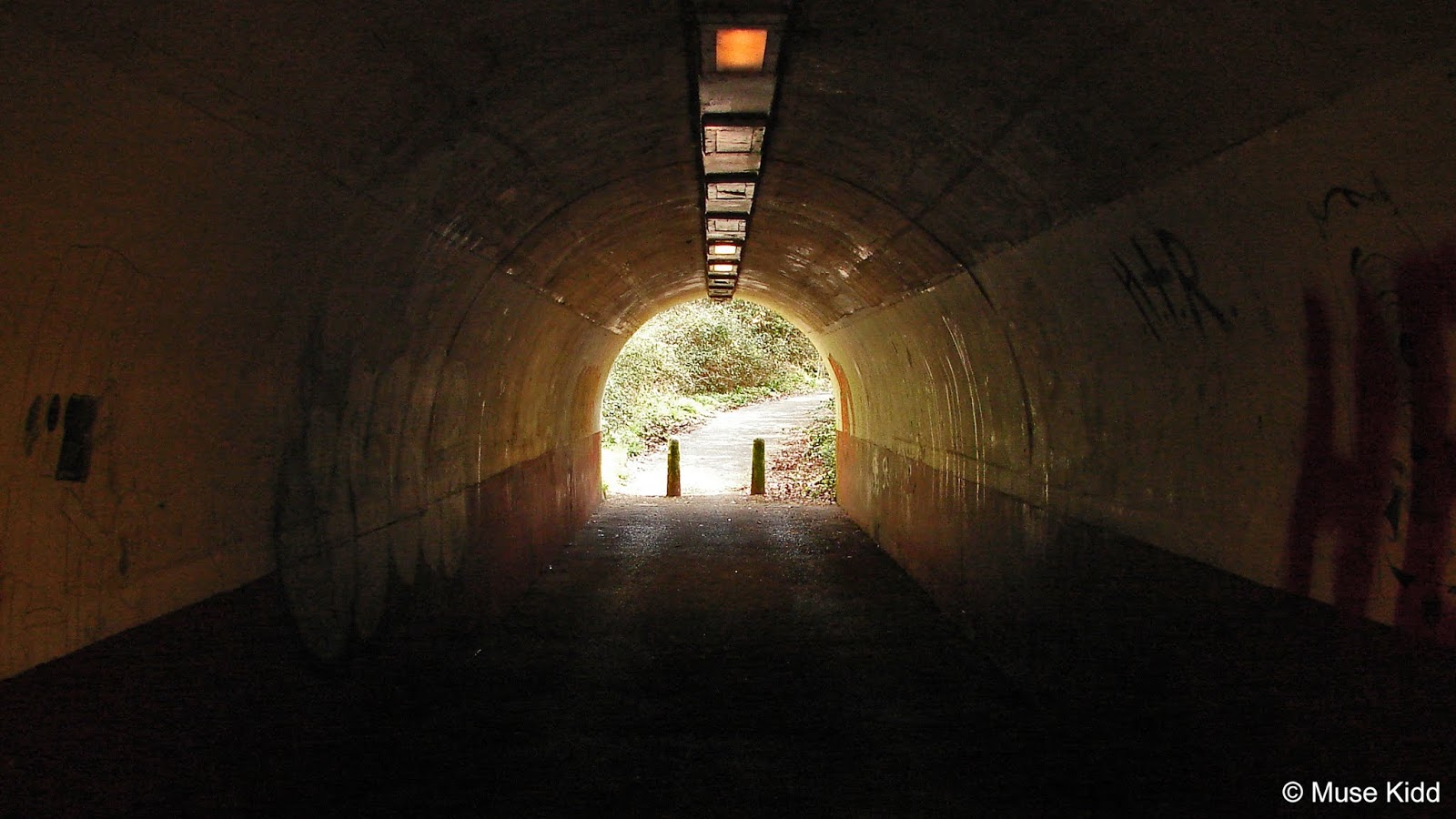
Elevation: +1,382 ft / -658 ft

This short tunnel and the following path are often covered in broken glass which requires getting off your bike and walking. Today, however; it was exceptionally clean.

After a short ride through town the route heads past the train station and under the lowest bridge I've ever seen to continue along a private farm road for a couple of miles to Rogiet.


From Rogiet, I crossed over the Severn Tunnel Junction Train Station for a fast ride along the B4245 to Undy. It's often a very busy road as it parallels the M48 coming to the junction of the M4.

At Undy it's back onto quiet roads heading across the Gwent Levels again. A much needed respite following the previous road and the time of day.


From here: it's man, bicycle, and road. If the wind is kind, you can make easy time of it. If the wind is against you, it's a long slow slog.


So it's the local architecture that I start to notice. And coming into Redwick, there are some very lovely homes. Although I've only traveled seven miles from Caldicot, this is good spot to take a break (I need one...). From here there won't be another village until I get to Newport.


The scenery is wonderful. It's quiet. You can hear a car coming for miles... cyclists talking, children playing, sheep and cows plodding about the fields.


The homes range from grand estates to equally large yet plain farm houses. The Gwent Levels are wide and flat and the road just goes on...


The miles slowly accumulate as does tiredness mixed with relief, accomplishment, and the longing to be home. It has been a full day.


Then at 95 miles under my saddle the road widens and I enter the city of Newport... just like that.


There she stands. My old friend the Transporter Bridge. There's a memorial by the river with a bench. I'll sit one more time for a brief snack to rest my legs and feet.

Leaving the Transporter Bridge I ride through a series of non-descript housing estates and busy villages to reach the last section of any real interest... Sirhowy Country Park.
| MINI GALLERY
Sirhowy Country Parc
        |
Well, you've made it to the end of my little diatribe. Congratulations! My adventure certainly lived up to what I was wanting - an epic ride. It is one of the longest single-days I've spent out on the road.
Needless to say, I was completely worn out when I finally reached home and I didn't do much for the next couple of days as I slowly recovered.
Thanks as always for visiting...
Cheers! - cm
| Ride Name: | Grosmont & SkenFrith | ||
| Start Date: | Sat. Apr. 23, 2018 | ||
| Starts in: | Oakdale, Wales, GB | ||
| Departed: | 5:58 AM | ||
| Distance: | 114.2 mi / 183.8 km | ||
| Elevation: | + 7,886 / - 7,896 ft | ||
| Max Grade: | 12.8% | ||
| Duration: | 16:50:11 | ||
| Move Time: | 10:59:39 | ||
| Stop Time: | 05:50:32 | ||
| Max. Speed: | 40.3 mph | ||
| Avg. Speed: | 10.4 mph | ||
| Weather: | cloudy | ||
| Temp: | 11°c / 52°f | ||
- Gallery: Llangynidr Commons
- Crickhowell
- Grosmont and Grosmont Castle
- NCN Route 46 and NCN Route 426
- Kentchurch and Kentchurch Court
- Garway
- My Rides: Garway & The Knights Templar
- Skenfrith Castle
- My Rides: Monmouth & Chepstow Classic
- Monmouth and Monnow Bridge
- Wye Valley and Wye Bridge
- Tintern Abbey
- NCN Route 4; Celtic Trail East
- Caerwent
- Gwent Levels
- Redwick
- Newport and Newport Transporter Bridge
- Sirhowy Park
▲ Back to top