This report is part two of my weekend exploring the Rhondda Valleys. Today's ride covers the lovely Rhondda Fawr Valley.
 |
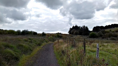
| Innocent looking lane heading out of town... |
Along with the two valleys I've explored, each ride also contains a significant mountain climb. The following report covers the second of these big climbs; the Bwlch. (My previous report covered The Rhigos.) Both mountian climbs are popular with cyclists and have been a featured part of the Tour of Britain in Wales numerous times.
Overview - Blaengarw & Nant-y-moel Tour
Distance: Distance: 84.7 miles
Elevation:+ 6314 / - 6313 ft
Duration: 13:06:03
The ride down to Pontypridd was just as I had made the day before... easy-peazy across NCN Route 47 to Quakers Yard and then down the Taff Trail (NCN Route 8). Both routes are well-marked and well-paved. ▼ Jump to Summary
Oakdale to Tonyrefail
At Pontypridd this time I got onto NCN Route 4 heading west. Now I've been on this route a few times and its lovely, BUT... I have to add that this section is one of the hardest I've ridden on the National Cycle Network. The climb out of Pontypridd is brutal to say the least. It is long and steep and seems to go on forever. (NOTE: You can see an annotation of this section on the map if you view the larger version... )
Note: I didn't take any photos of the climb. But once at the top, the ride is really lovely and rolls along through some seemingly isolated valleys thick with trees and lush overgrowth.
 |
| Looking over yonder valley... |
 |
| Time to ride back down... |
 |
| A sudden change in road surface... |
 |
| Looks like an adventure to me... |
 |
| Looking back over my shoulder... |
 |
| Nothing but the sound of wind... |
 |
| and bird calls... |
 |
| and in the distance a dog is barking... |
 |
| and the sheep hear it all. |
Thank goodness I had brought along my Ordinance Survey maps. Plus, I had my Garmin Tour... so between the two I successfully navigated my way out of there! What this means to you dear reader... is that I didn't document my confusion. (You can see it on the map though...HA!)
 |
| Crossing paths... |
Ogmore Junction to Blaengarw
Once back on course, the route was fabulous... yet again. In fact, looking back I can't believe I didn't take more photographs? It's a testament to how pretty this little country is. I was completely in the zone of "gazing at the beauty of Wales".
 |
| Down along the Ogmore River, the scenery changes completely... |
 |
| Yup, those are real flowers... |
 |
| From high mountain passes to thick wooded jungle... |
I found the path at Llangeinor by the old train station where it comes out of the woods and settles up along the old Gawr Valley rail line. I have to say, from here on up to the top of the valley was like stepping back in time. The entire area just felt as if it was cut off from the rest of the world.
 |
| Once a bustling and lively train station is now a lovely and quiet home... |
 |
| nuthin' but the sounds of chickens and my tyres rolling along... |
 |
| With no idea of what lies ahead... |
 |
| Little gems appear... |
 |
| with the whisper of a secret valley discovered... |
 |
| At the end of the road... |
 |
| Another look around... |
 |
| before heading back down the path as I had arrived... |
 |
| Abandoned?... Disused?... |
 |
| Forgotten?... Unappreciated?... |
 |
| No! |
 |
| Sleeping perhaps... |
 |
| Awaiting a second life... |
 |
| I'm just loving these old rail lines... |
 |
| How perfect to convert them to walking and cycle paths? |
 |
| And how best to see the valleys? |
 |
| Hello pony! |
 |
| Looking back down the valley. |
 |
| Looking up and out of town... |
Summary - Blaengarw & Nant-y-moel Tour
This was the second day of my tour where I set out to explore the Rhondda Valleys. These valleys; the Rhondda Fach and Rhondda Fawr, are west of where I live and normally ride. They are of equal notoriety for their role in the coal mining industry during the heydays of the Industrial Revolution, yet they are now somewhat removed from common routes.
Thanks as always for stopping by.
Cheers! - cm
 |
Report Card |
|
| Ride Name: |
Blaen & Nant |
| Start Date: |
Sun. Aug. 14, 2016 |
| Starts in: |
Oakdale, Wales, GB |
| Departed: |
7:17 AM |
| Distance: |
84.7 mi / 136.31 km |
| Elevation: |
+ 6314 / - 6313 ft |
| Max Grade: |
13.2% |
| Duration: |
13:06:03 |
| Move Time: |
08:28:49 |
| Stop Time: |
04:37:14 |
| Max. Speed: |
33.5 mph |
| Avg. Speed: |
10.0 mph |
| Weather: |
clouds, sun |
| Temp: |
19°c / 66°f |
